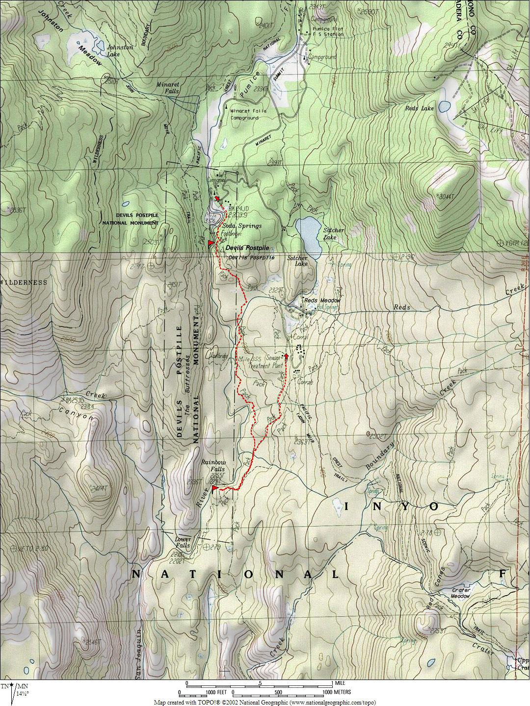
|
Devil's
Postpile National Monument to Rainbow falls
| Distance |
3.62 Miles - Round Trip |
| Type |
Semi-loop |
|
Season |
Mid or late |
| Recommended
Trip |
1
day
|
| Topo Maps |
|
| Trailhead |
Devil's Postpile Trailhead.
(Devil's Postpile Tram Stop) |
| Elevation |
Beg/End
7563'/7670''
Gain/Loss
+396'/-289' = 107' |
| Avg. Grade |
5% |
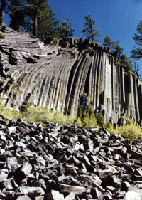
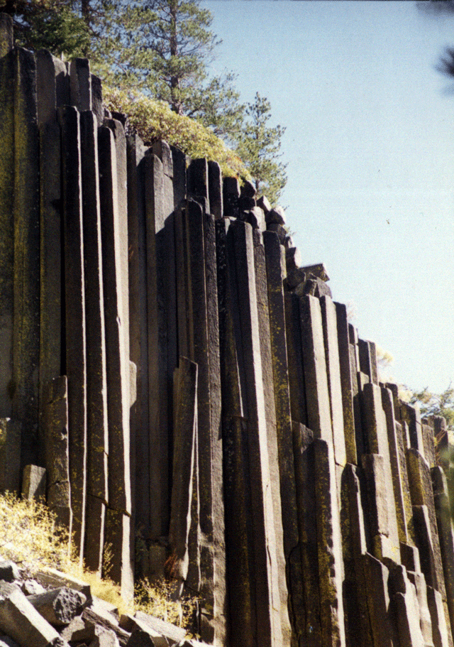
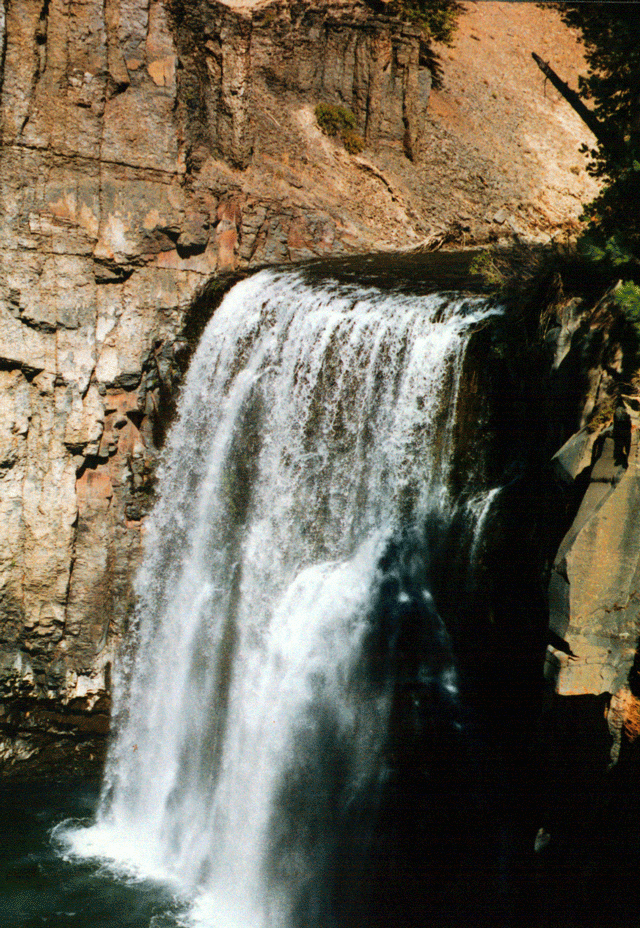
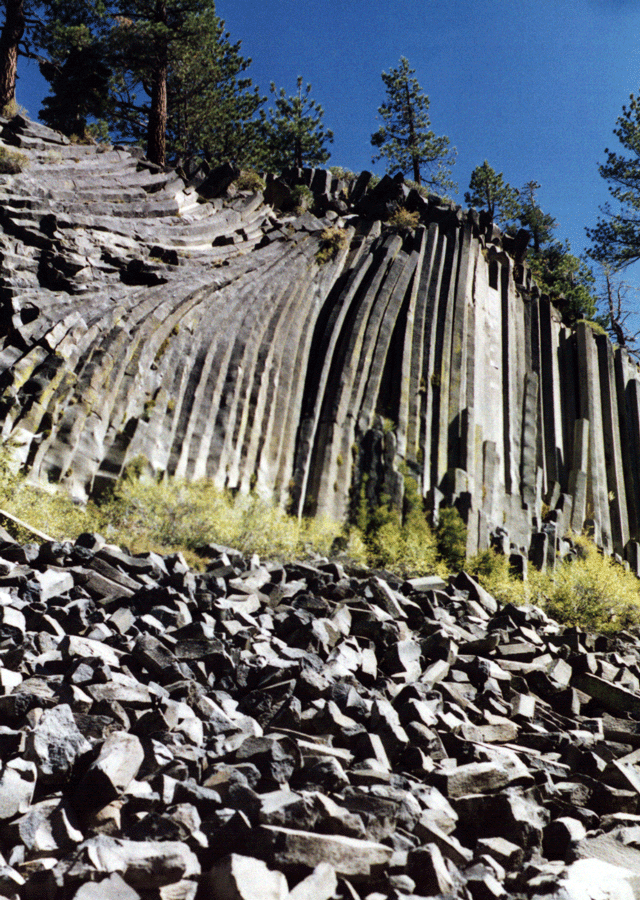
Devil's Postpile National Monument: The hike to Devil's Postpile is
very easy, and is mostly downhill all the way to Rainbow Falls. The postpile
is beautiful with its geologically interesting hexagonal posts, which were
formed from drying lava. The lava is basalt and the piles were caused by
erosion which broke pieces of the posts into the piles blow. The top of
the PostPile is completely smooth, 10,000 years ago a glacier carved away
the top layers of the postpile, leaving a shiny, and very slippery finish!
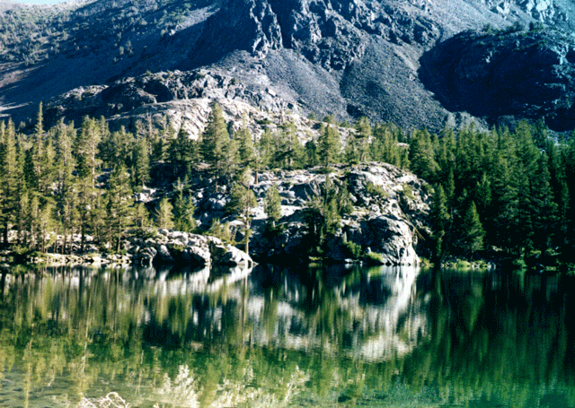
Other notable places to visit are Starkweather lake which is a small lake
which is turning into a meadow. The lake is stocked regularly with trout, and
occasionally Alper's Trout. Sotcher lake is the largest lake along the road,
and is also stocked with trout. There are also elusive German Browns in the
lake, some weighing over 20 pounds have been caught in the lake. Also of
note along the lake are beavers and their dams. The best way to see the
Postpile and Rainbow falls is to start at the Devil's Postpile Ranger
Station and hike along the San Joaquin River to the Postpile, and then
continue down to Rainbow falls. The hike to the Postpile is only about 1/3
of a mile, and then about 2.2 miles to Rainbow Falls. For more
information:
www.nps.gov/depo/depomain.htm |


